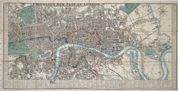
New Plan of London
1845
Castle Museum in Łańcut
Part of the collection: Cartography
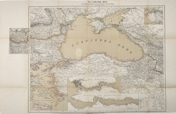
Map of Crimea with a plan of siege operations south of Sevastopol Carta della Crimea col piano delle operazioni di assedio al Sud di Sebastopoli The 19th century was only a time of the industrial revolution, scientific and technical progress, and development of the state administration, but also the rise of people travelling the continent and beyond it. In the so-called “Century of Steam”, there was a rapid increase in the population of cities. The first cities with a population of a million appeared in Europe. This resulted in greater demand for detailed city plans and larger areas included as territorial administrative units. The maker and published of the map was John Arrowsmith (1790–1873). He came from a family involved in publishing maps and geographical atlases. Their company was located in London. The maps published by Arrowsmith were very modern for their time in terms of production techniques and the detailed content. The second part of the map shows the city of Sevastopol, as of about 26 September 1854. The author presented in detail the position of the allied troops during the siege of the fortress city. It should be mentioned here that in 1853–1856, a bloody war was waged on the Balkan Peninsula and in Crimea. It has passed into history as the “Crimean War”, a conflict between Russia and the Ottoman Empire, France, Great Britain and the Kingdom of Sardinia. In this conflict, Russia sought to seize the straits connecting the Mediterranean with the Black Sea, and to gain influence in the territories inhabited by an Orthodox Christian population. The conflict ended in Russia’s defeat, and the last battles were fought in Crimea, until they were interrupted by the siege and capture of Sevastopol. The map is foldable and bound in a cardboard cover, with the map title and the year 1855 written on it. The Counts Potocki – like most Polish aristocrats – liked to travel, hence a large collection of plans and maps has survived. In this case, we have an example of their interest in politics. Łukasz Chrobak
Author / creator
Object type
Cartography
Technique
flat print
Material
paper, paint
Creation time / dating
Creation / finding place
Owner
Castle Museum in Łańcut
Identification number
Location / status

1845
Castle Museum in Łańcut

1877
Castle Museum in Łańcut

19th / 20th century
Castle Museum in Łańcut
DISCOVER this TOPIC
Museum of King Jan III's Palace at Wilanów
DISCOVER this PATH
Educational path