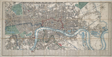
New Plan of London
1845
Castle Museum in Łańcut
Part of the collection: Cartography
The 19th century was only a time of the industrial revolution, scientific and technical progress, and development of the state administration, but also the rise of people travelling the continent and beyond it. In the so-called “Century of Steam”, there was a rapid increase in the population of cities. The first cities with a population of a million appeared in Europe. This resulted in greater demand for detailed city plans and larger areas included as territorial administrative units. The presented topographical and political map, titled “The Black Sea”, depicts the eponymous title, the Sea of Azov, the Aegean Sea, and the Sea of Crete. In addition to them, we have the southern part of the Russian Empire – Crimea, southern Ukraine, and areas of the Caucasus. Moreover, the adjoining Ottoman Empire (Turkey), the Kingdom of Romania, the Kingdom of Serbia, Greece, as well as a fragment of Austria-Hungary. The map has no publication date beyond a pencilled-in “1877”. This date appears to be credible, for several reasons. First, the territory of Turkey encompassed Thracia, Bulgaria, Macedonia, Dobruja, and areas of today’s Albania. Romania was a young state after the unification of Wallachia and Moldavia, with no access to the sea, which it received only in 1878 after the treaty in Berlin. Another element is the lack of an independent Bulgaria. This state gained broad autonomy in 1878 after the Treaty of San Stefano, and only then, after several centuries, appeared again on the map of Europe. The borders of these countries did not change significantly until 1912 and 1913, after the two Balkan wars. Additionally, the most important cities in this part of Europe and Asia have been marked on the map. In addition, two smaller maps are included: a topographical map of Sevastopol and a land use plan of Constantinople (then Istanbul) and the Bosphorus Strait. The map is foldable, but it does not have a binding or case. The Counts Potocki – like most Polish aristocrats – travelled extensively, hence a large collection of plans and maps has survived. Łukasz Chrobak
Author / creator
Object type
Cartography
Technique
flat print
Material
paper, paint
Creation time / dating
Creation / finding place
Owner
Castle Museum in Łańcut
Identification number
Location / status

1845
Castle Museum in Łańcut

20th century
Castle Museum in Łańcut

1826
Castle Museum in Łańcut
DISCOVER this TOPIC
National Museum in Lublin
DISCOVER this PATH
Educational path