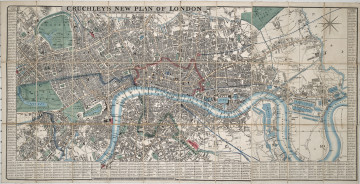
New Plan of London
1845
Castle Museum in Łańcut
Part of the collection: Cartography
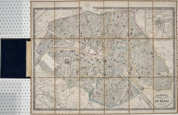
The presented object shows the plan of the fortified city of Paris from 1858. The plan was designed during the time of the Second French Empire, under the rule of Napoleon III – the nephew of Napoleon I. The plan includes all of the city of Paris and its outskirts. It is fairly detailed and includes all streets, squares, and the most important office buildings. Another element is the marked course of the railway line. Along the borders of the city, marked in red, were fortifications of brick and earth. There were 14 forts defending access to the city limits on the foreground of the French capital. The fortress was erected during the reign of King Louis Philippe d’Orléans in 1841–1844. Map legends are visible on four edges of the plan. The collection of the Łańcut Museum includes maps that are most likely souvenirs from the numerous travels of the Counts Potocki, two ex libris bookplates from their library are visible on the reverse of the plan. This is one of those cases. The map is foldable and can be stored in its original cardboard and fabric case. Łukasz Chrobak
Author / creator
Object type
Cartography
Technique
flat print
Material
paper
Creation time / dating
Creation / finding place
Owner
Castle Museum in Łańcut
Identification number
Location / status

1845
Castle Museum in Łańcut

19th (?) century
Castle Museum in Łańcut

1850
Castle Museum in Łańcut
DISCOVER this TOPIC
National Museum in Lublin
DISCOVER this PATH
Educational path