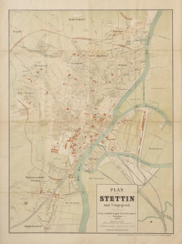
Plan von Stettin und Umgegend | Plan of Szczecin and the surrounding area
1894
National Museum in Szczecin
Part of the collection: Iconography of Szczecin in the 17th-19th centuries
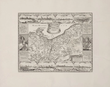
Szczecin became part of the Kingdom of Prussia in 1720, although the city had been under Prussian occupation since 1713. Immediately after taking control, the Prussians began expanding the fortifications, originally built by the Swedes in the 1630s. Under the rule of the new monarch, Szczecin was transformed into a modern fortress. Plans for the expansion were drawn up in 1713, and the earthworks and construction took place between 1724 and 1740. The designer and chief builder of the fortifications was Gerhard Cornelius de Walrave (1692–1773), a Dutch-born architect and military engineer who served the Prussian monarchs from 1715 to 1747. The construction work, personally supervised by Walrave, included rebuilding the medieval gate system. Ultimately, Szczecin’s fortifications consisted of the main defensive walls surrounding the city and three forts: Fort Wilhelm to the west, Fort Leopold to the north, and the five-sided Fort Prusy to the south. The displayed copy of a 1734 plan shows the existing fortifications on the north and west sides of the Old Town, including Fort Prusy, as well as the planned Fort Wilhelm – whose construction began in 1735 – and the proposed location of Fort Leopold. The original was drawn by Walrave himself, as confirmed by his signature at the bottom of the drawing. The copy was made by Philipp Loth von Seers, commander of the Corps of Engineers and Walrave's collaborator, most likely between 1734 and 1740. The plan also marks the artillery range from the planned Fort Wilhelm towards the two neighbouring fortifications. Additionally, the plan includes annotations, either handwritten or dictated by King Frederick William I of Prussia, showing his final approval of the project. Małgorzata Peszko
Author / creator
Object type
city map
Technique
techniki kreślarskie, rysunek tuszem, akwarela, printing, manual script
Material
papier czerpany z filigranem
Origin / acquisition method
legal transfer
Creation time / dating
Creation / finding place
Owner
The National Museum in Szczecin
Identification number
Location / status

Friedr. Nagel, Szczecin (1842 - około 1945)
1894
National Museum in Szczecin

Michaelis, Johann Wilhelm
1720 — 1736
National Museum in Szczecin

Suchodolski January
między 1852 — 1860
National Museum in Szczecin
DISCOVER this TOPIC
Castle Museum in Łańcut
DISCOVER this PATH
Educational path
0/500

We use cookies to make it easier for you to use our website and for statistical purposes. You can manage cookies by changing the settings of your web browser. More information in the Privacy Policy.
We use cookies to make it easier for you to use our website and for statistical purposes. You can manage cookies by changing the settings of your web browser. More information in the Privacy Policy.
Manage cookies:
This type of cookies is necessary for the website to function. You can change your browser settings to block them, but then the website will not work properly.
WYMAGANE
They are used to measure user engagement and generate statistics about the website to better understand how it is used. If you block this type of cookies, we will not be able to collect information about the use of the website and we will not be able to monitor its performance.